
TrailBivvy Where could I sleep tonight?
TrailBivvy is an offline-first iPhone app for long treks and thru-hikes. Late in the day it shows where you could stop for the night within your remaining daylight and walking time — and says plainly what it does not know.
In development — not yet on the App Store
TrailBivvy is a prototype. There is no public version, no download and no release date yet.
The core principle
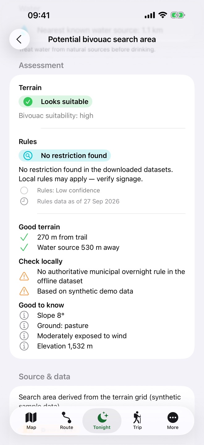
Terrain and rules, kept apart
TrailBivvy never tells you that a place is legal or allowed for the night. Rules for overnight stays depend on the country, the region, the municipality, protected areas, the season and the landowner — and no dataset holds all of them.
Terrain
Does the ground look physically suitable? Slope, surface, shelter, water, hazards and the weather at your arrival time. In the current build, terrain data exists only for the synthetic Via Alpina demo.
Rules
Is there a known rule about overnight stays in the downloaded data — a protected area, a national or regional rule, a season?
The two are assessed separately. A known restriction always outweighs good terrain, and missing data stays “unknown” — it never turns into a green light.
No restriction found in the downloaded data — local rules may apply.
Bivouac suggestions are generalised search areas with a radius of at least 200 m, never exact pitches, so that quiet places do not turn into crowded spots.
Every status is shown as a symbol and words, never by colour alone
- Looks suitable — no restriction found in the downloaded data. Still check locally.
- Caution — caveats about terrain, weather or rules.
- A known restriction or unsuitable terrain rules it out.
- Unknown — not enough data. Check locally.
In the development build
What TrailBivvy does
Every feature below exists in the current development build. Where the data has limits, we say so.
-
Sleep Tonight
Overnight options within your daylight and walking-time budget: campsites, huts, shelters and village accommodation, plus bivouac search areas where terrain data exists. Each one shows the arrival time, effort, detour, weather at arrival, nearby water, the rules situation and how confident the data is.
Terrain data exists only for the synthetic Via Alpina demo (Swiss stages CH 7–CH 14), so catalogue trails and imported routes get no bivouac search areas. The app does not know whether a hut or campsite is open — check with the operator.
-
Offline maps and downloads
Official national maps where available — swisstopo in Switzerland, IGN in France, basemap.at in Austria, BKG in Germany, IGN España in Spain, Kartverket in Norway and USGS in the USA — with Apple Maps elsewhere. Download a route corridor before you go; downloads resume tile by tile and are rate-limited.
In the current build, offline map tiles can be downloaded in Switzerland, Liechtenstein, France, Austria, Germany, Spain and the USA; whether each provider’s terms allow offline storage is still being reviewed. Elsewhere — including Italy, the UK, the Balkans and Scandinavia — there is no offline base map: carry a paper map.
-
Trail catalogue
Catalogue trails are built into the app as offline packs made from OpenStreetMap data. OpenStreetMap is open, crowd-sourced data that is not officially surveyed. A Via Alpina demo with synthetic data shows how everything fits together, and you can import your own GPX, GeoJSON or KML route.
Trails in the current build 8 · Europe and the USA
Route data © OpenStreetMap contributors, available under the Open Database License (ODbL).
-
Stage profiles and planner
Browse stages with an elevation profile, climbs and markers. Reverse, combine or split stages and plan a multi-day trip. On the trail, see the distance and ascent remaining and an arrival time based on DIN 33466, adjusted to your own pace as you record trips.
Off-route alerts are debounced and take GPS accuracy into account, to avoid false alarms.
-
Safety tools
Your coordinates in decimal degrees, DMS, DDM and Swiss LV95; share your position through the iOS share sheet; the nearest settlement, hut, shelter, transport and water; and emergency numbers for the country you are in. Mountain weather adjusted to your altitude, cached with its fetch time, with a thunderstorm-risk indicator.
Emergency numbers are being checked by a person before release. Near a border the app can pick the wrong country; 112 works across Europe. The thunderstorm indicator is not an official warning.
-
Trip recording and GPX
Record a trip with track statistics, stored compactly on your iPhone, and export it as GPX. Import routes as GPX, GeoJSON or KML; imported files stay on your device.
Imported routes carry no rules data, so overnight assessments on them read “unknown — check locally”.
-
34 languages, your units
English and 33 other languages, including Arabic and Hebrew with a right-to-left layout, Japanese, Korean and Chinese. Distances in metric or US customary units, or automatically from your device settings.
The translations are machine-assisted and still need review by native speakers.
-
Private by design
No account, no analytics, no ads and no third-party SDKs. There is no TrailBivvy server: trips, waypoints, photos and notes stay on your iPhone. Only requests to online services such as map tiles and weather leave the device, without identifiers; the weather request uses a position rounded to about 100 m.
A look at the app
Screenshots from the development build.
-
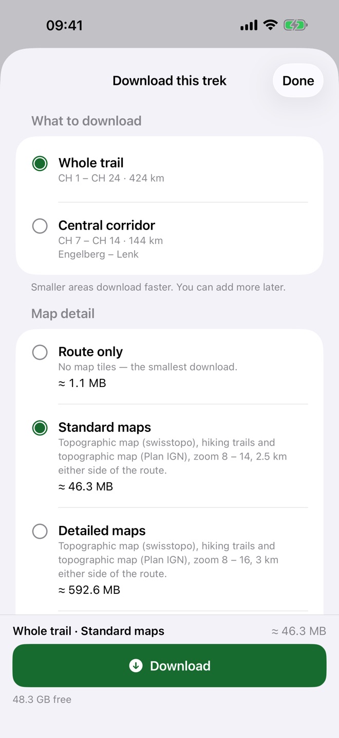
Download your trek before you go Shown with demo data -
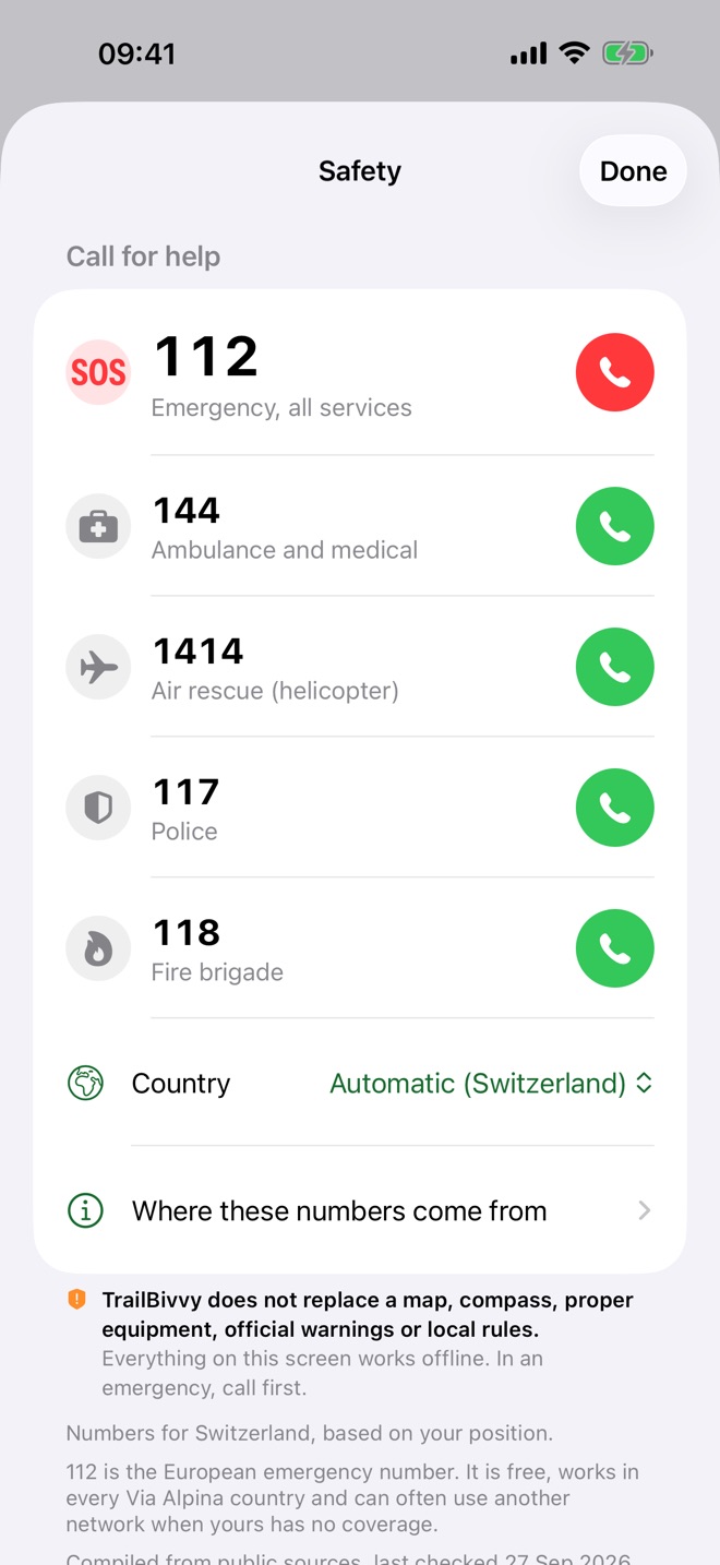
Emergency numbers, available offline Shown with demo data