
Press kit
Facts, descriptions and images for writing about TrailBivvy. Please describe it as an app in development: it is not on the App Store yet.
In development — not yet on the App Store
Fact sheet
- Name
- TrailBivvy
- What it is
- Offline-first trek and bivouac planner for iPhone
- Status
- Prototype in development. Not on the App Store; no release date and no price.
- Platform
- iPhone, iOS 18 or later
- Languages
- English and 33 other languages (machine-assisted, native review pending)
- Units
- Metric or US customary
- Trail catalogue
- 8 trails · Europe and the USA
- Data
- Trail packs built from OpenStreetMap (open data, not officially surveyed); a Via Alpina demo with synthetic data
- Privacy
- No account, no analytics, no ads, no third-party SDKs, no TrailBivvy server
- Built with
- Swift and SwiftUI, Apple frameworks only
- Independence
- Not affiliated with any trail association, mapping agency, park or authority
App icon

PNG, 1024 × 1024 pixels

The icon may still change before release.
Short description
TrailBivvy is an offline-first iPhone app that helps long-distance hikers answer one question at the end of the day — where could I sleep tonight? — without ever claiming that a place is legal or allowed.
Long description
TrailBivvy is an iPhone app for long treks and thru-hikes, currently in development. Its central feature, Sleep Tonight, looks at your position, the daylight left and your own walking pace, and lists overnight options within reach: campsites, huts, shelters, village accommodation and generalised areas where the terrain looks suitable for a bivouac (so far demonstrated on synthetic terrain data only).
Honesty about rules is the core of the product. Rules for overnight stays vary by country, region, municipality, protected area, season and landowner, and no dataset holds all of them. TrailBivvy therefore keeps physical suitability and rules information apart, lets any known restriction win, labels missing data as unknown, and never describes a place as legal or allowed.
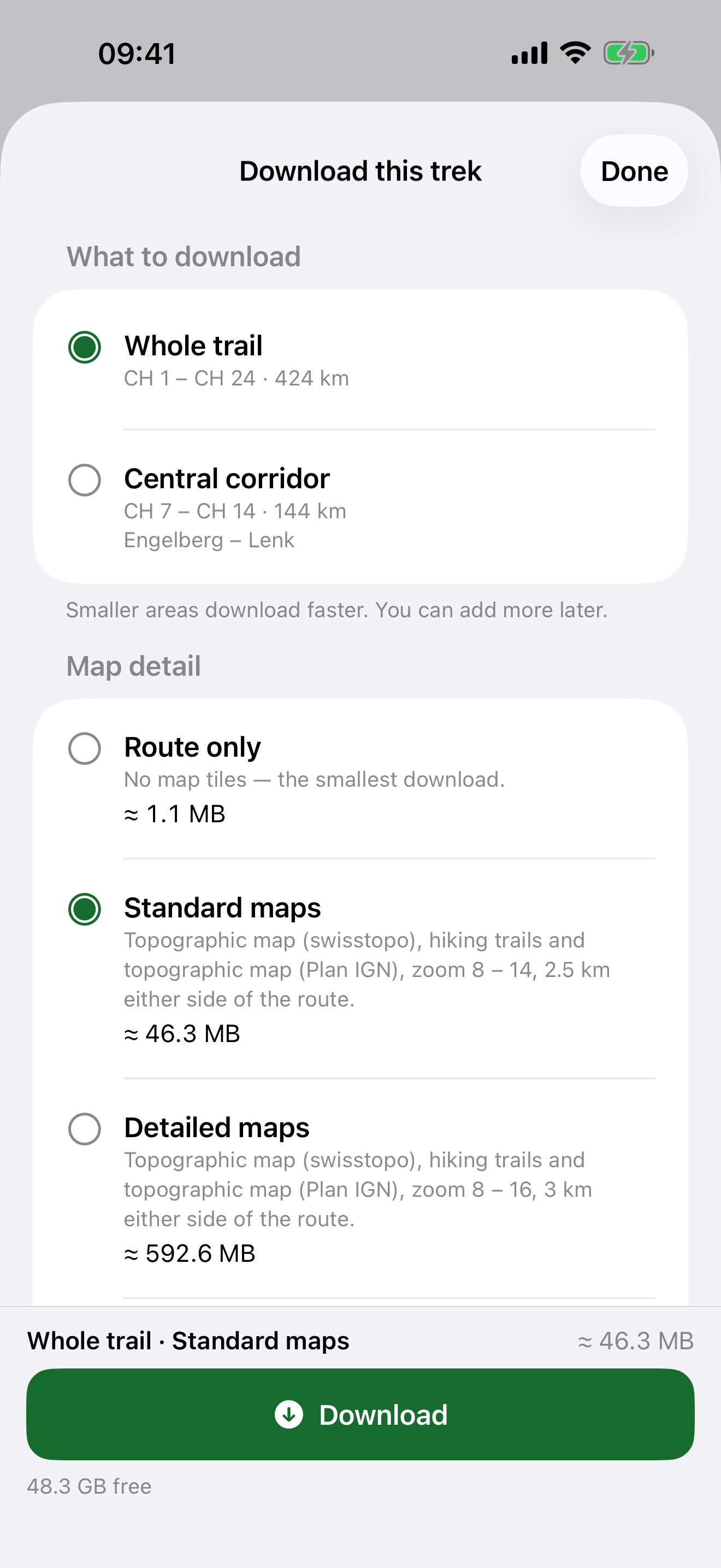
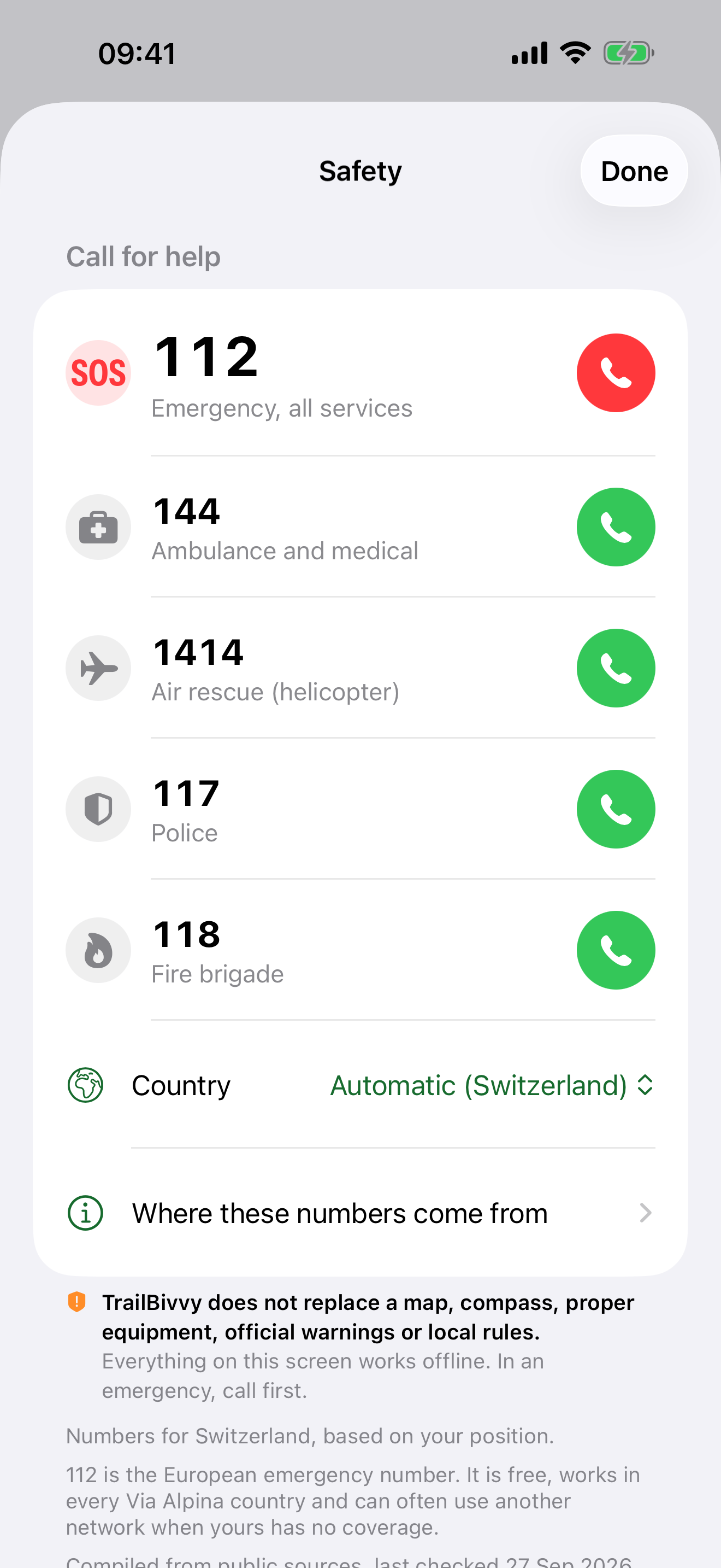
The app is built to work offline. Catalogue trails are built into the app as offline packs made from OpenStreetMap data. Map tiles from official national map services can be downloaded for a route corridor where the app offers offline storage for that map; whether each provider’s terms allow this is still being reviewed. It also offers stage profiles and a multi-day planner, safety tools, trip recording with GPX export, 34 languages, and metric or US units.
TrailBivvy has no account, no analytics and no ads, and runs no server: personal data stays on the device. It is an independent project, not affiliated with any trail association, mapping agency, park or authority.
Screenshots
Screenshots show the development build. Where marked, they use demo data.
-
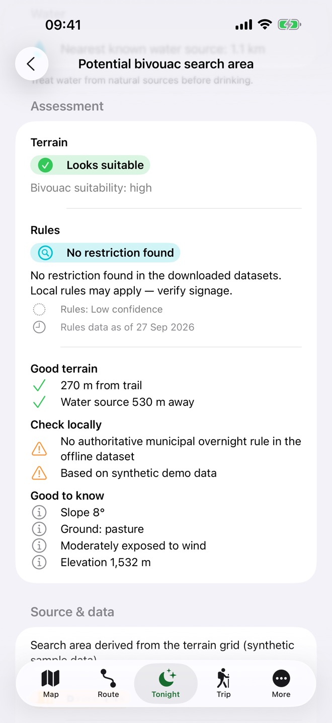
Terrain and rules, explained — never guessed Shown with demo data Terrain and rules, explained — never guessed, Full size (PNG, 1320 × 2868 px, 0.6 MB) -
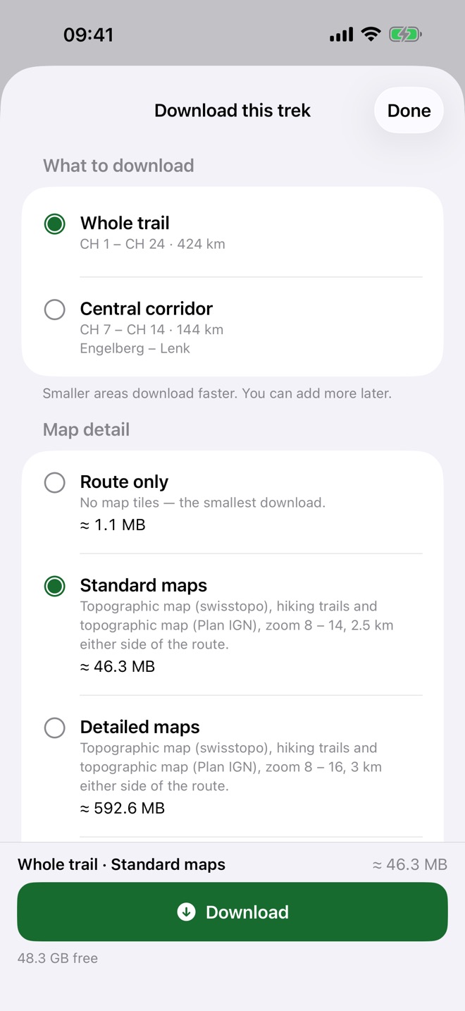
Download your trek before you go Shown with demo data Download your trek before you go, Full size (PNG, 1320 × 2868 px, 0.3 MB) -
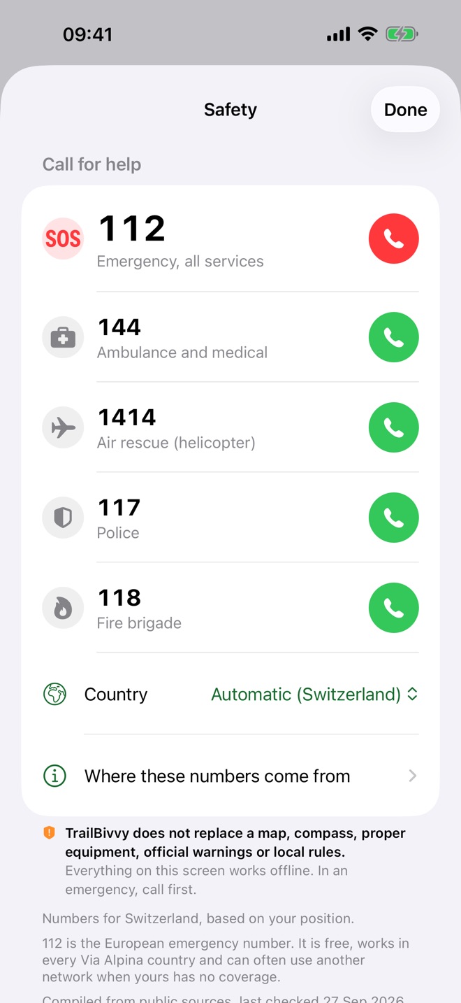
Emergency numbers, available offline Shown with demo data Emergency numbers, available offline, Full size (PNG, 1320 × 2868 px, 0.3 MB)
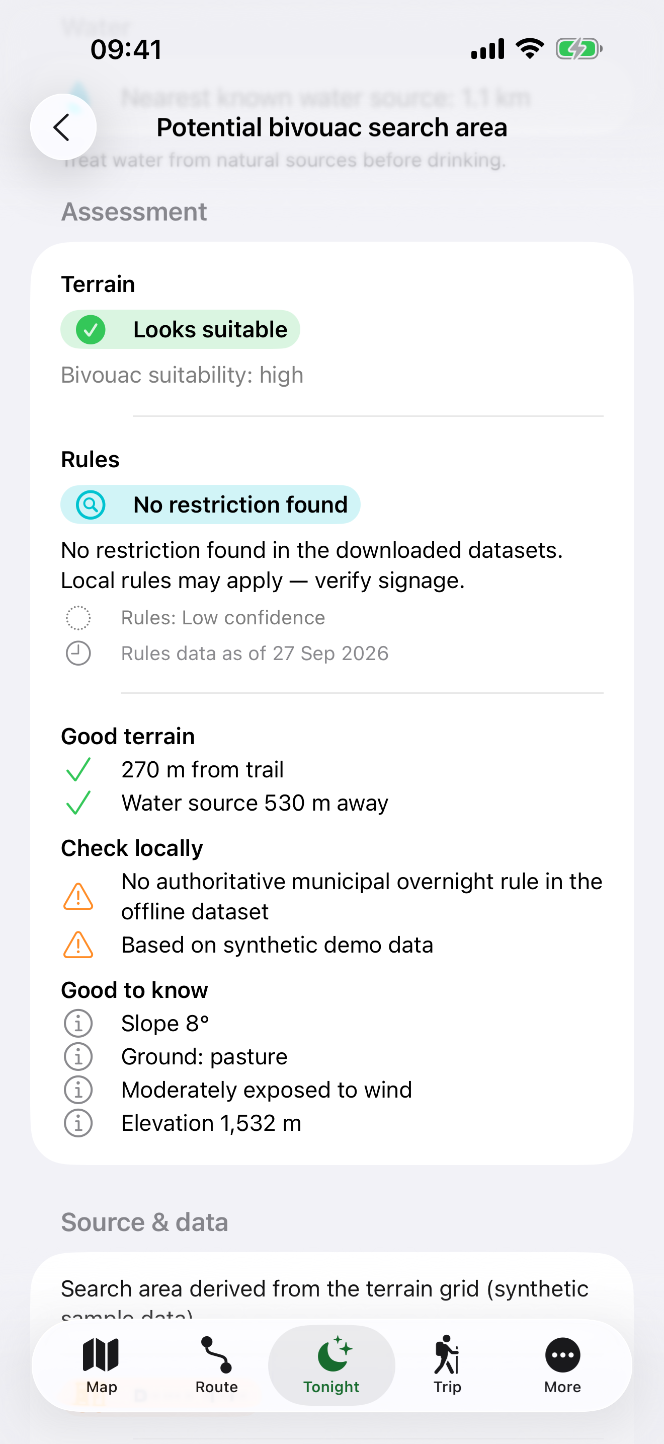
A note on wording
Please do not describe TrailBivvy as showing where camping is legal, allowed or safe — it deliberately makes no such claim. Where screenshots contain map imagery, it belongs to the map provider (for example “© swisstopo”); reusing it may need the provider’s permission. Keep the credit visible and do not crop the map attribution.